Following days of heavy rainfall across the region, Rough River Lake has reached its spillway level for the first time in recent memory for local officials. It’s raising concerns about both upstream and downstream flooding in communities near Falls of Rough, Hartford, Dundee, Livermore, and other parts of Ohio County.
The U.S. Army Corps of Engineers (USACE) Louisville District confirmed that the lake hit spillway crest — an elevation of 524 feet above sea level — at 11 p.m. on April 4 and continues to rise. Current data from the National Water Prediction Service show the river reached 530.1 feet at 3 p.m. on Monday, exceeding the previous record high of 527.3 feet in 2011.
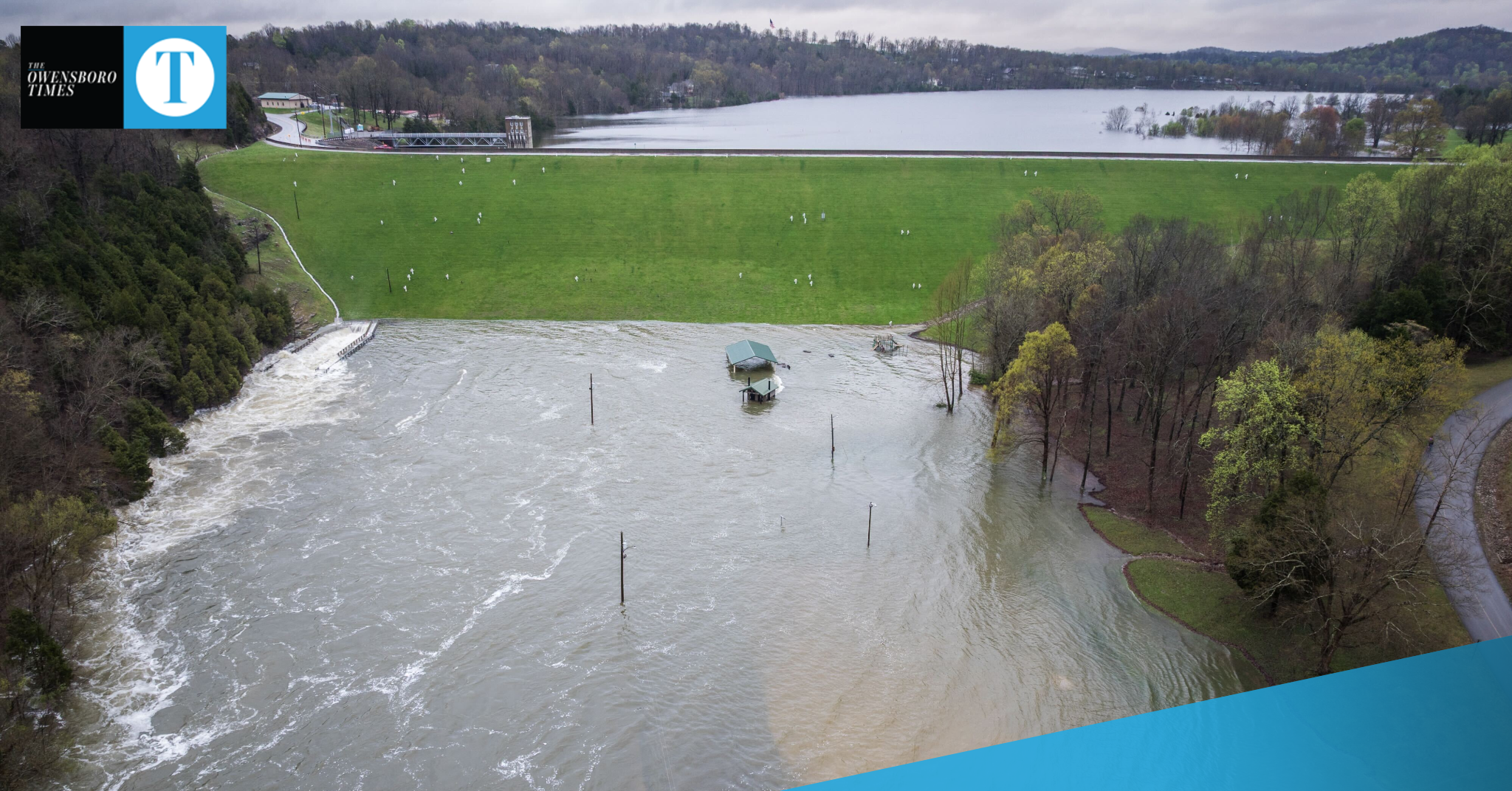
Officials emphasize that a spillway event is not a dam failure. The spillway is part of the dam’s design to safely release excess water once the reservoir reaches full capacity.
“Rough River Dam is operating as it was designed to do, and there are no safety concerns at this time,” said Adam Connelly, Water Resources Section Chief for USACE Louisville District. “However, even with the dam functioning properly, downstream flooding remains possible when water is released in large quantities.”
What does this mean for local residents?
- Downstream areas at risk include Falls of Rough, Hartford, Dundee, Livermore, and other communities along the Rough River.
- Upstream impacts could occur to homes and roads while the lake is above 527 feet.
- Lakeshore properties could also be affected. Residents with items near the shoreline and below the “yellow line” (flowage easement) are urged to move them immediately.
- Floodwaters will continue to rise as more rain falls. The lake was already 91% full as of Friday morning, with very little room left for runoff before water began spilling over.
The Corps is working closely with local and state emergency managers, performing 24/7 onsite monitoring and twice-daily inspections of the dam’s structure and instruments.
New mapping tool helps residents see potential impact
To help residents better understand how high water might impact their property, USACE has released a new online map tool called the Rough River Lake Viewer.
The interactive tool shows projected flooding levels from 510 to 536 feet above sea level. While the map provides a reasonable estimate of potential water coverage, officials caution that it should be used for planning only and not as a guarantee.
- To view the map, click here to see the Rough River Lake Viewer.
- To check live lake levels, click here.
- For regional downstream flooding maps, scroll to the “Flood Inundation Category” on the National Weather Service or click here.
Stay alert, stay safe
USACE urges residents to stay alert as forecasts show rainfall totals could exceed 15 inches in parts of Kentucky, Indiana, and Ohio. Flood risk remains high throughout the weekend and into next week.
Public safety remains the top priority, and officials encourage families to have a flood plan in place. For tips, visit ready.gov/floods.
For ongoing updates from the U.S. Army Corps of Engineers Louisville District, follow their Facebook page at facebook.com/LouisvilleUSACE.
USACE said Rough River Dam was completed in 1959 and provides flood control for nearly 89 miles along the Rough River and 71 miles along the Green River. It has prevented more than $360 million in flood damage since its construction. The dam is currently undergoing a multi-phase improvement project, with the construction contract for the next phase scheduled to be awarded in August 2025.