
The National Weather Service (NWS) in Paducah has issued a Winter Storm Watch that will be in effect from Wednesday afternoon through Thursday afternoon.
Heavy mixed precipitation is possible with total snow accumulations of 2 to 5 inches, and ice accumulations of around one-tenth of an inch are possible.
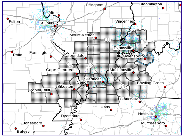
The watch is in effect for portions of southwest Indiana, southeast Missouri, western Kentucky and southern Illinois. The highest snow accumulations are expected over parts of southern Illinois, southeast Missouri, and part of the Purchase Area of West Kentucky. Lesser amounts of snow, possibly mixed with ice are likely over the southern Pennyrile region of west Kentucky.
A wintry mix of precipitation will be possible during the Wednesday evening rush hour over the southern Pennyrile and southern Purchase area of west Kentucky. Snowfall and mixed precipitation will then spread across the southeast Missouri, Southern Illinois and southwest Indiana Wednesday Night and Thursday morning.
Drivers should plan on slippery road conditions Wednesday night and Thursday morning. These hazardous conditions could impact the morning or evening commute.
According to the NWS, a Winter Storm Watch means there is potential for significant snow, sleet or ice accumulations that may impact travel. The NWS suggests residents in these areas continue to monitor the latest forecasts.