Hazardous road conditions across Daviess County this morning prompted warnings from local officials as the National Weather Service forecasts a significant winter storm late this week that could bring heavy snow and dangerous cold to the region.
In an email Wednesday morning, the NWS said patchy freezing rain may create slippery travel conditions across the Quad State area. The email said temperatures are expected to warm through the morning, which should help limit widespread impacts.
The Daviess County Sheriff’s Office reported multiple weather-related crashes on county roads and the Wendell H. Ford Expressway (Owensboro Bypass) on Wednesday morning. In a public statement, the sheriff’s office urged motorists to allow extra time and reduce speeds, saying deputies and other emergency personnel were working numerous wrecks and that drivers should use caution.
The NWS said confidence continues to increase that a significant winter storm will impact the region from Friday night through Sunday afternoon. Several inches of snow are possible, especially within the Winter Storm Watch area issued on Wednesday. The statement said forecast guidance continues trending north, increasing the chance that heavier snow may reach western Kentucky.
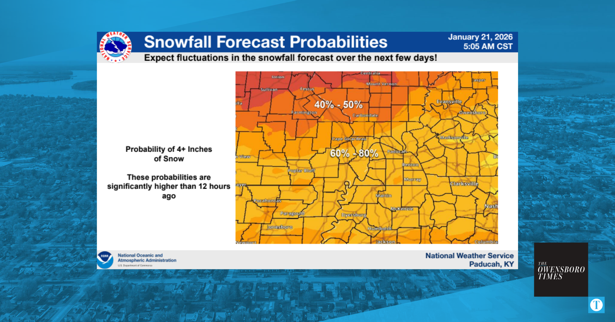
Briefing data issued early Wednesday showed a 60 to 80 percent chance of at least 4 inches of snow across much of western Kentucky, with a 40 to 50 percent chance of totals exceeding 6 inches in some areas. One lingering uncertainty is how far north snowfall will reach due to a possible sharp cutoff caused by dry air.
The storm may produce moderate to major impacts, including hazardous or impossible travel, closures, and infrastructure disruptions. Behind the system, Arctic air is expected to move in, with wind chills dropping below zero and possibly near 10 below at times over the weekend.
Residents are urged to monitor forecasts and prepare for hazardous conditions as early as Friday night. The NWS said it will refine the forecast as new guidance arrives, with additional updates expected later Wednesday.