A major winter storm is expected to impact the region from late Friday night through Sunday, according to the National Weather Service in Paducah. A Winter Storm Warning has been issued as of 2:40 p.m. Thursday, with forecasters warning of significant snowfall, potential ice accumulations, and dangerously cold temperatures through the weekend.
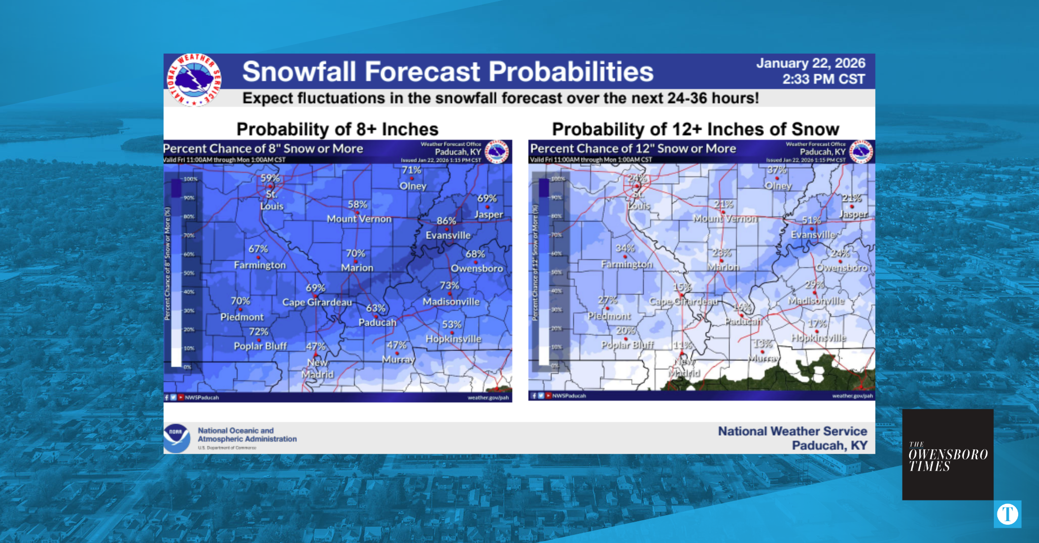
The Weather Service reports high confidence that many areas will receive at least 8 inches of snow, with some locations potentially seeing more than 12 inches. The heaviest snowfall is likely to occur Saturday afternoon through Sunday morning. In the southern parts of western Kentucky and southeast Missouri, snow may mix with or change over to sleet and freezing rain at times.
Travel is expected to be significantly impacted. Roads may become hazardous or impassable, and the risk of widespread closures and infrastructure disruptions is elevated. The National Weather Service is urging residents to monitor forecasts closely and prepare for hazardous travel conditions beginning as early as late Friday night.
Forecasters are still monitoring how dry air will affect snow totals, particularly along the northern edge of the storm system. The exact onset timing of precipitation and how far north the mixed precipitation will reach also remain uncertain.
Winds could gust up to 20 mph during the storm, creating blowing and drifting snow and reducing visibility to less than a mile in some areas. The character of the snow will vary across the region—light and fluffy in the north, and heavier and wetter in the south. This may complicate snow removal efforts, especially where sleet or freezing rain is involved.
Ice accumulations are forecast to be highest in the far southeast portions of the region, with some areas potentially receiving up to 0.75 inches of ice.
Temperatures are expected to plummet during and after the storm, with wind chills dipping below zero and possibly nearing 10 degrees below at times. The National Weather Service advises extreme caution during exposure and encourages proper layering for those who must be outdoors.
The next scheduled forecast update is expected by 5 a.m. Friday. Residents are encouraged to finalize preparations, check on vulnerable neighbors, and ensure they have reliable emergency heat sources and supplies on hand.