Update 9:30pm: Event cancelled. Severe Thunderstorm Watch from 9:29 PM to 12:00 AM CDT for Daviess County.
———————
Update 4:45pm: Severe Thunderstorm Watch from 8/20/2018 4:49 PM to 8/21/2018 12:00 AM CDT for Daviess County.
———————
Update 9:00am:
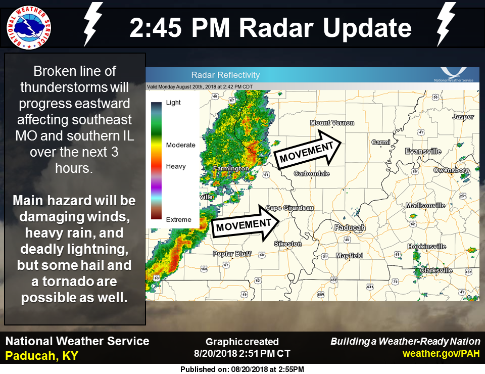
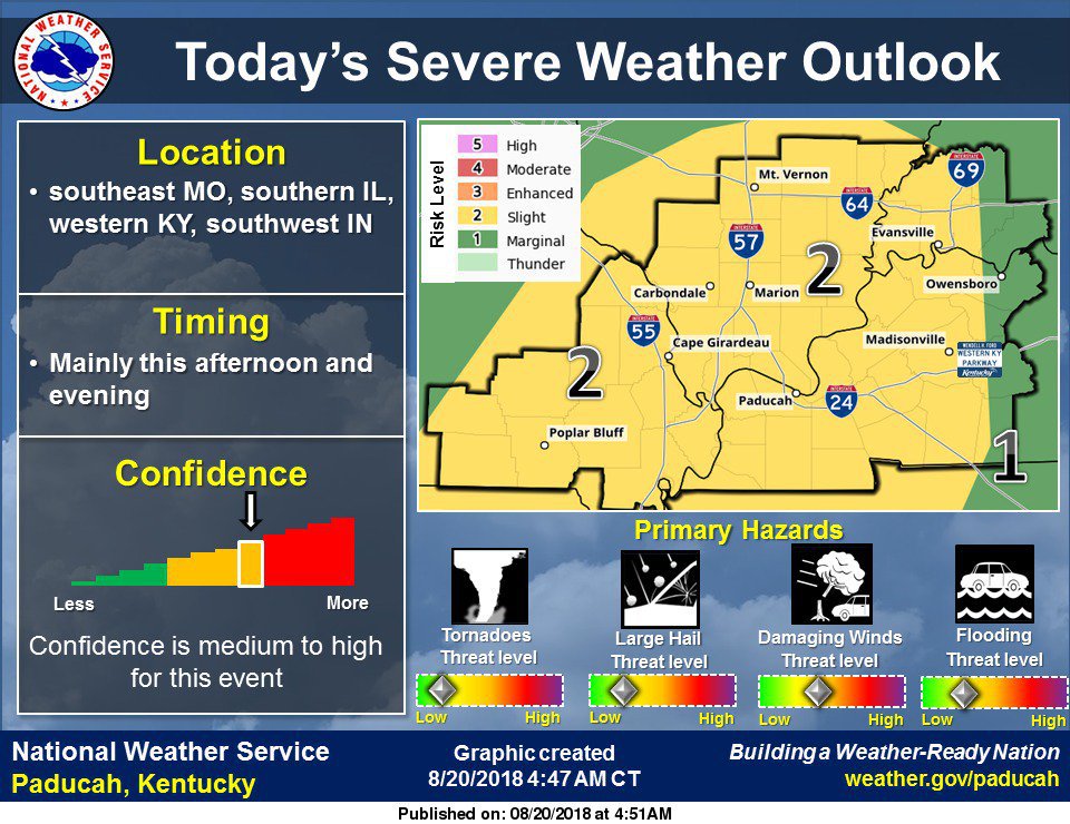
According to the National Weather Service in Paducah, most of the region is outlooked in a slight risk for severe thunderstorms today, primarily this afternoon and evening. An initial non-severe band of thunderstorms should exit the region this morning. New storm development is expected from southern Missouri into southwest Illinois by early to mid-afternoon. This activity will progress east across the remainder of the region during the late afternoon and evening. Storms should begin to weaken during the evening with loss of daytime heating.
Damaging wind is the primary thunderstorm-related concern today. However, large hail and a brief tornado are also possible with a few of the storms, especially with the initial development in southeast Missouri. Lightning and torrential downpours are also expected with thunderstorm activity.
A slight chance of thunderstorms lingers into Tuesday across southwest Indiana and adjacent portions of southern Illinois and western Kentucky. Severe storms are not expected.