Forecasters say parts of western Kentucky could see four inches or more of snow and wind chills below zero this weekend. The growing threat comes as a separate round of light wintry precipitation could bring isolated slick spots to the Owensboro area early Wednesday morning.
A mix of sleet and freezing drizzle is possible around daybreak Wednesday, according to the National Weather Service in Paducah. Temperatures are expected to rise above freezing shortly after precipitation begins, limiting widespread impacts, but forecasters cautioned that a few slick spots could develop during the early morning commute.
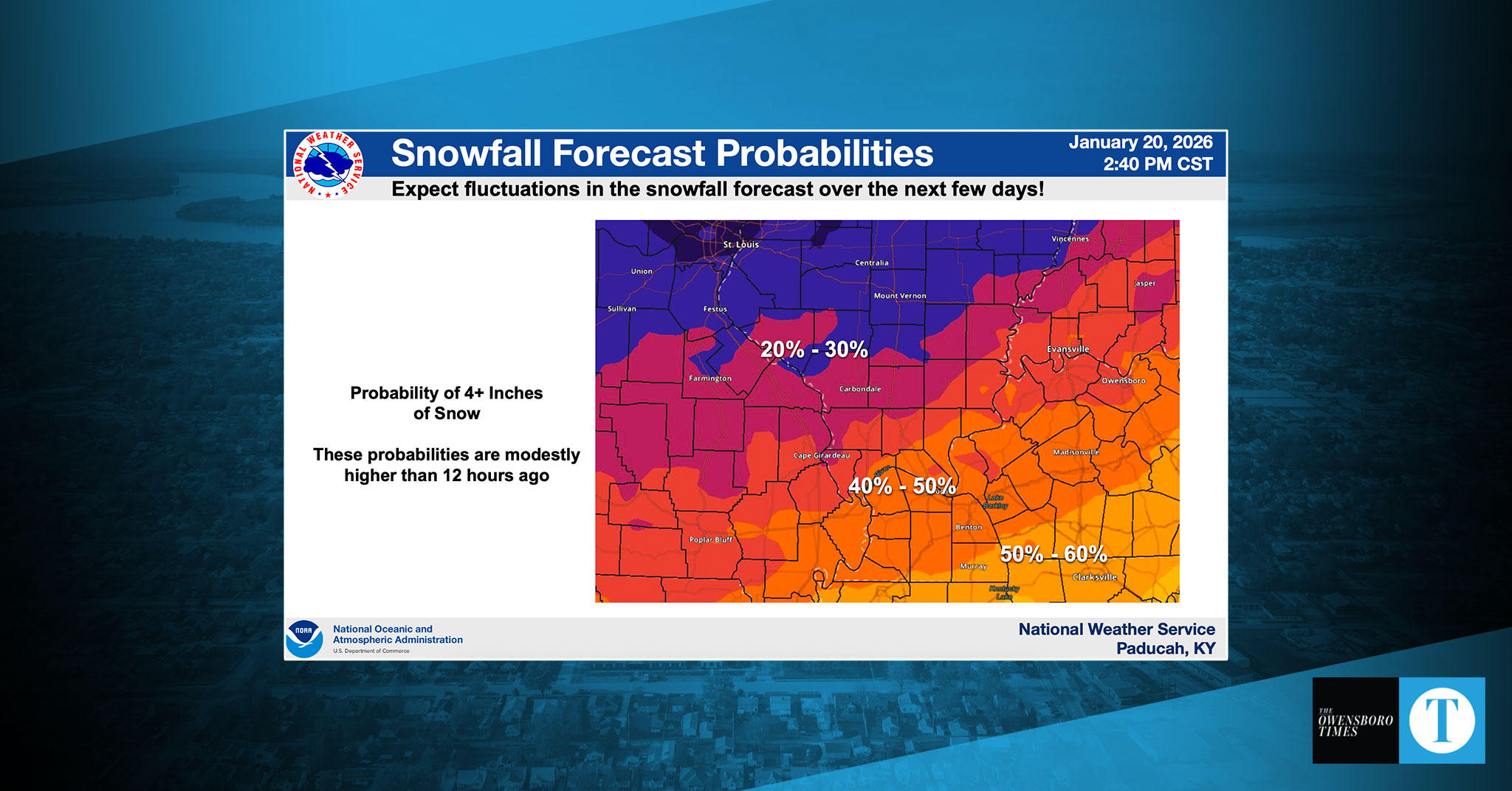
Looking ahead to the weekend, meteorologists said the risk for accumulating snow had grown “modestly” throughout the day Tuesday, particularly across the southern half of the region.
“The large-scale pattern is favorable for a broad area of snow,” forecasters said in a Tuesday afternoon briefing. “Still too soon for specific amounts, but likely enough to have some impact.”
Forecasters said a surge of cold, dry air from the northwest is expected to interact with a developing storm system, creating uncertainty about where the heaviest snowfall will set up. That interaction could result in a sharp cutoff in snowfall totals somewhere across the region, they said.
Across parts of western Kentucky and southern southeast Missouri, the probability of at least moderate impacts — defined as four inches or more of snow — has climbed into the 50% to 60% range, with some areas farther south seeing probabilities as high as 60% to 70%.
Some forecast models are showing the potential for higher totals, including amounts in the 8- to 12-inch range, but National Weather Service forecasters said it is too early to responsibly predict snowfall that high.
“Those amounts are plausible with this system, but we just can’t responsibly forecast values that high yet,” Lead Forecaster Justin Gibbs said. “There is too much influence/pressure from that dry, dense cold air from the northwest to start talking those type of impacts.”
The weekend system is also expected to usher in dangerously cold air, with wind chills potentially dropping below zero at times, forecasters said.
Residents are encouraged to monitor forecast updates closely and prepare for potentially hazardous travel conditions as early as Friday night, especially for trips south of the Owensboro area.
The National Weather Service said forecast confidence and snowfall placement should become clearer over the coming days as the system develops.